Rwanda was one of the last countries in the mapped in the world due to its location are the heart of Africa…
Rwanda as Part of German East Africa
The German East African colonial administration only reached Nyanza in 1893; Gustav Adolf von Götzen met the mwami. Rwanda was on the edge of the German East Africa. It was only in 1910 at the convention of Brussels that the borders of Rwanda were fixed.
1. 1892 German East Africa map showing little detail of Rwanda…

German East Africa – 1892 – (10MB)
2. German East Africa by 1905…

German East Africa – 1905 – (3MB)
3. German East Africa administrative map; Rwanda being administrative area XX/20…
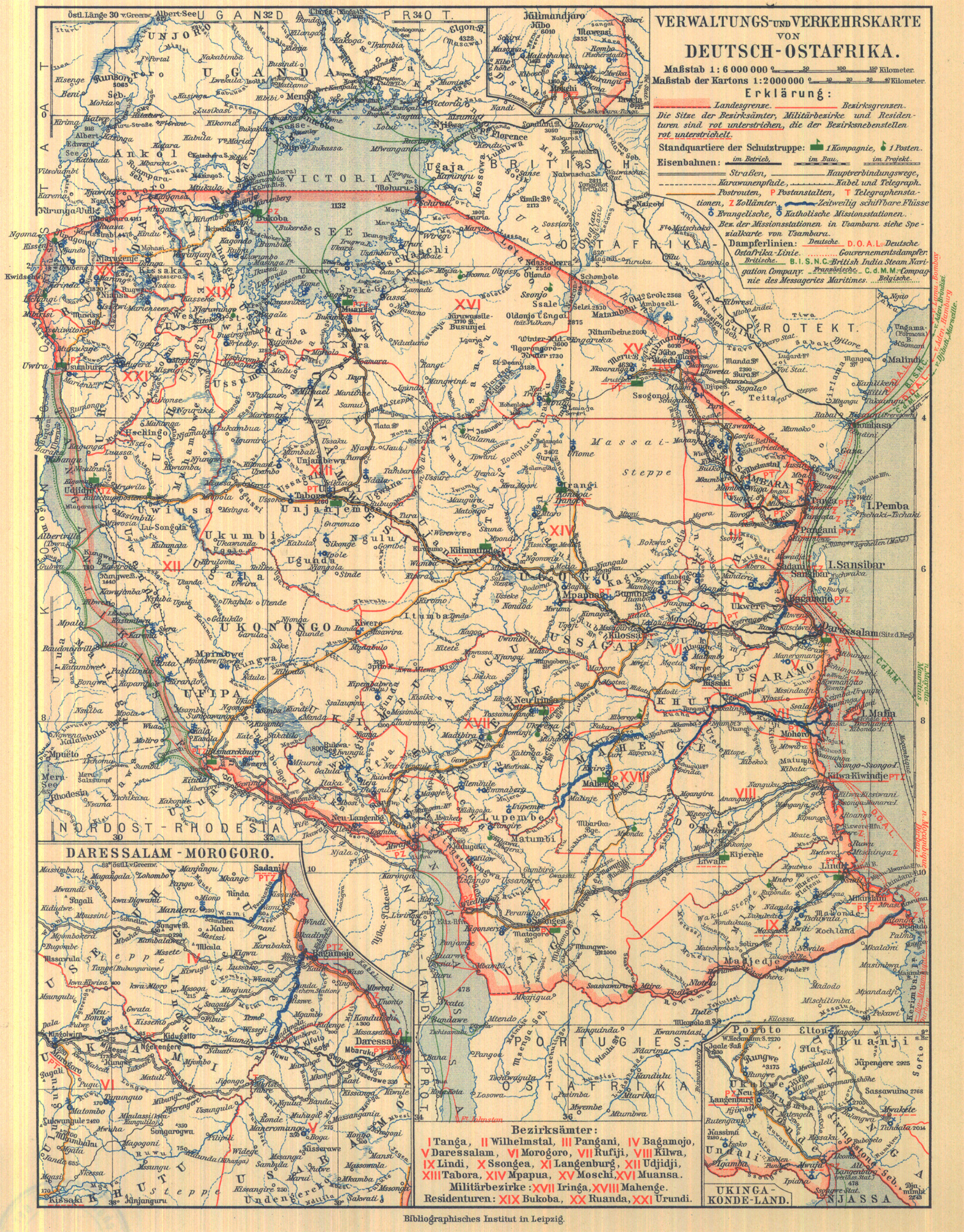
German East African Administrative Districts – (2MB)
4. German East Africa map of peoples.

German East African Peoples – (2MB)
5. German East African vegetation map.
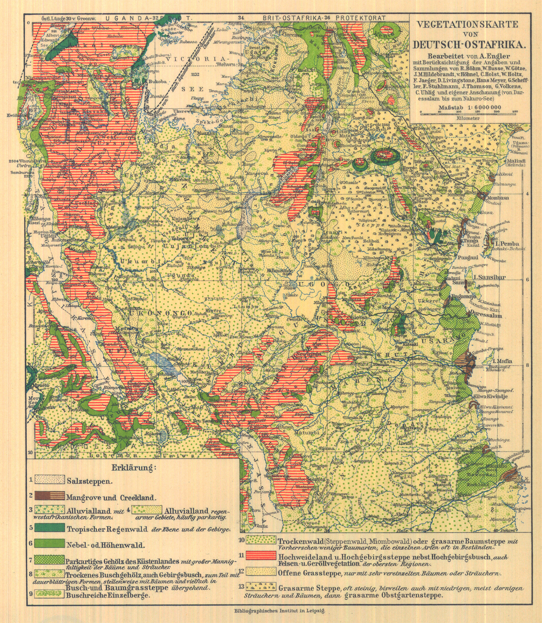
German East African Vegetation – (2MB)
Rwanda as Belgium a Colony
In 1916, Belgium was given a mandate by the league of nations to govern Rwanda and Burundi. Belgium governed Rwanda until independence in 1961.
6. Ruanda and Urundi 1938…

Ruanda and Urundi – 1938 – (6MB)
7. Rwanda and Burundi 1 to 200,000 scale in 1942.

Rwanda 200,000 scale – 1942 – (9MB)
8. Rwanda and Burundi 1 to 100,000 scale in 1942.

Rwanda 100,000 scale – 1942 – (32MB)
9. Rwanda in 1943. Who new that Bukavu was called Costermansville?

Rwanda 1,000,000 – 1943 – (855kB)
Rwanda After Independence to 1994
Rwanda had a fitful time as a republic. In 1973 military rule was established lead by Juvénal Habyarimana. Habryarimana rule lasted until has assassination on 6th April 1994.
10. American military map; compiled in 1968 and updated in 1994.

Rwanda 1,000,000 – 1994 – (876kB)
11. Pre 1994 Rwanda. Note the size of Akagera national park and its associated hunting area. It is detailed. The closer you look the more you see…
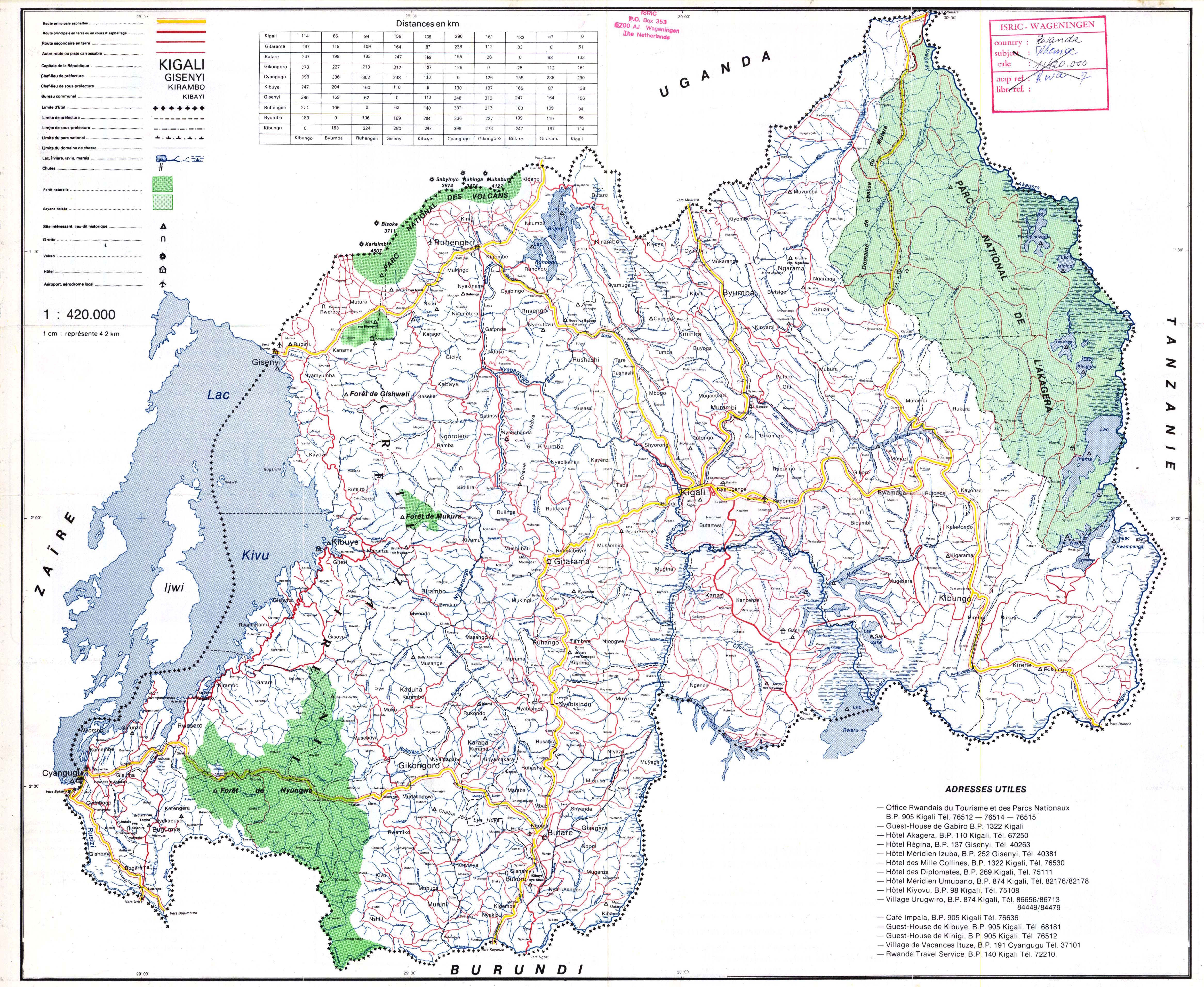
Rwanda 420,000 scale (3MB)
Rwanda Post 1994 and Today
12. A tourist’s paradise…

Rwanda Tourist Map (772kB)
Rwandan Geology
13. Geology not rocket science…

Rwandan Geology Map (8MB)
14. There are minerals in them there hills…
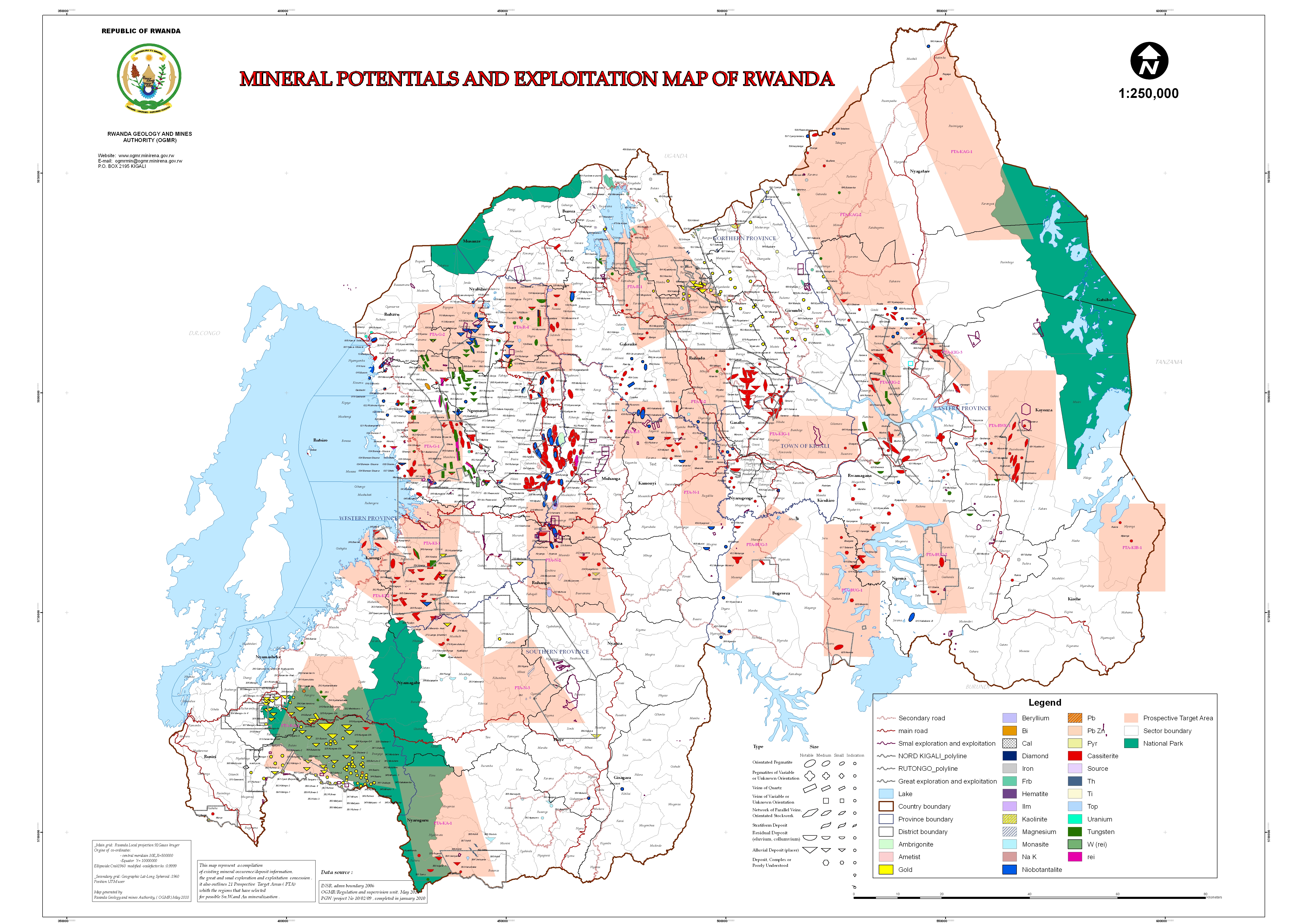
Rwanda Mineral Potential (6MB)
Rwanda Vegetation
15. Figure out which of 100 different types of vegetation applies…

Rwandan Vegetation Map
16. That’s a relief… map of Rwanda…

Rwanda Elevation Map (1MB)
Lake Kivu
17. Lake Kivu close up…
Lake Kivu – (73MB)
Kigali
18. Kigali in 1994…

Kigali – 1994 – (454kB)
19. Kigali tourist map today…

Kigali Tourist Map – (10MB)
What Was…
20. What was…

Rwanda in the 19th Century – (771kB)
What Could Be…?
21. What could be…?

